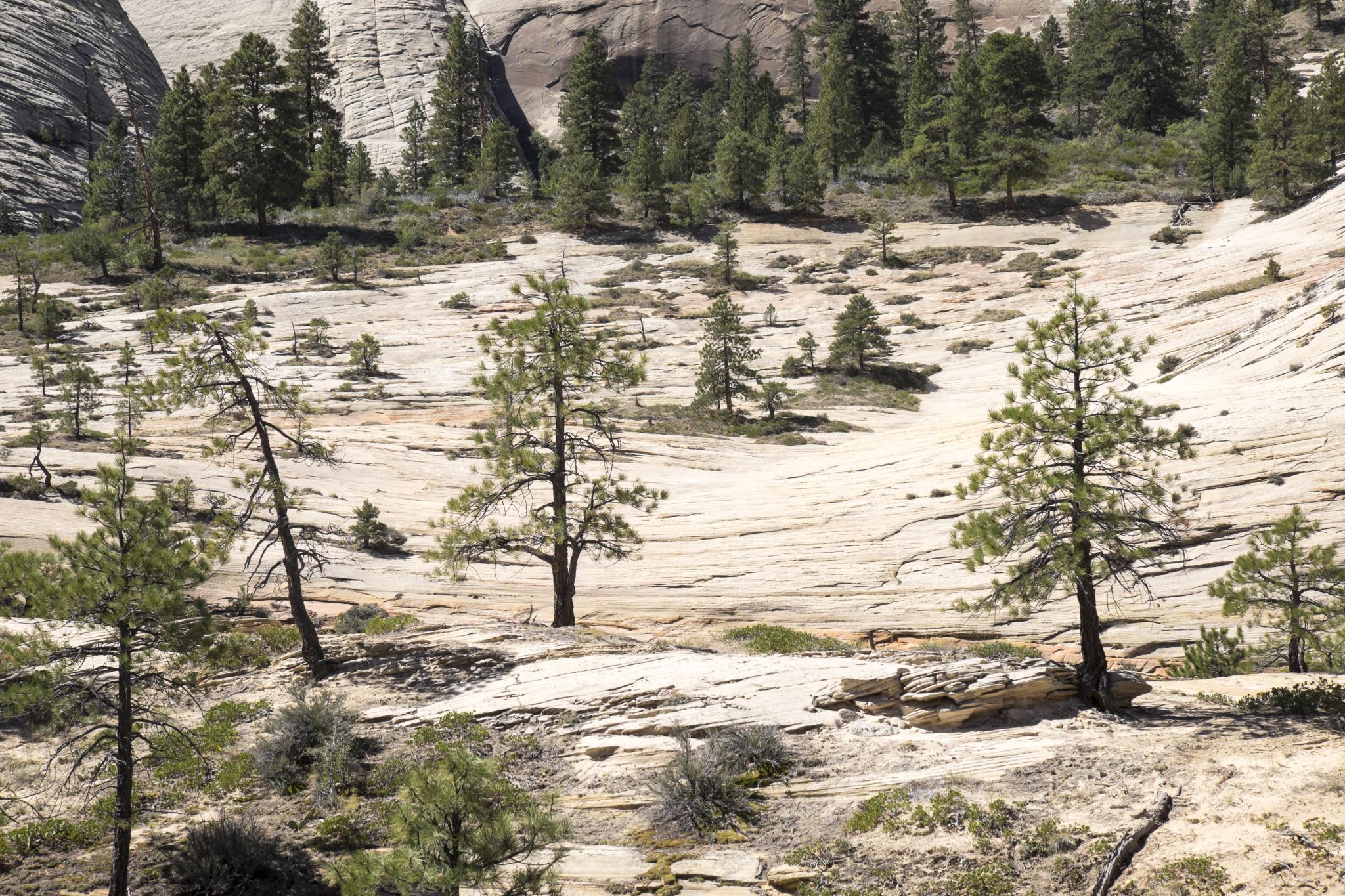
The Left Fork Trail in Zion National Park, also known as the Subway hike from the bottom up, offers a challenging 6.9-mile round trip adventure. This moderately strenuous to strenuous hike features a 1,000-foot elevation gain, multiple stream crossings, and stunning geological formations. Hikers navigate through rocky terrain and wade through water to reach the iconic Subway, a narrow slot canyon with vibrant colors and crystal-clear pools. The trail provides breathtaking views of red ledges, waterfalls, and unique rock formations, making it a must-do for experienced hikers visiting Zion.
What Makes Left Fork Trail Zion Unique?

The Left Fork Trail Zion stands out for several reasons:
- Geological wonders
- Diverse terrain
- Photographic opportunities
- Physical challenge
This hike offers a perfect blend of natural beauty and adventure, making it a favorite among outdoor enthusiasts. The trail’s unique features include:
- The Subway: A tubular slot canyon with smooth, curved walls
- Emerald pools: Crystal-clear, blue-green water pools
- Cascading waterfalls: Several small waterfalls along the route
- Red rock formations: Stunning sandstone cliffs and ledges
- Dinosaur tracks: Fossilized footprints visible along the trail
How to Access the Left Fork Trail Zion?

Reaching the Left Fork Trailhead requires some planning:
- From Zion Visitor Center, drive west on UT-9 for about 12 miles to Virgin.
- Turn right onto Kolob Terrace Road.
- Follow Kolob Terrace Road for approximately 8.2 miles.
- Look for the Left Fork Trailhead on the right side of the road.
| Information | Details |
|---|---|
| GPS Coordinates | 37.2633° N, 113.0886° W |
| Distance from Visitor Center | 21.5 miles |
| Driving Time | 30-35 minutes |
| Parking Capacity | Approximately 10 vehicles |
| Facilities | Vault toilets available |
It’s crucial to arrive early, as parking is limited and fills up quickly during peak seasons.
What Should Hikers Expect on the Left Fork Trail Zion?
The Left Fork Trail Zion presents a variety of challenges and experiences:
- Initial steep descent: The trail begins with a rocky, steep downhill section.
- Stream navigation: Hikers must cross the stream multiple times.
- Unclear paths: Some sections of the trail are not well-defined.
- Diverse terrain: From sandy beaches to boulder fields and slickrock.
- Water obstacles: Wading through water is necessary at various points.
Hikers should be prepared for:
- Wet conditions
- Slippery rocks
- Potential for flash floods
- Varying water levels
- Exposure to sun and heat
What is the Best Time to Hike Left Fork Trail Zion?
Timing is crucial for a safe and enjoyable experience on the Left Fork Trail Zion:
- Season: Late spring to early fall is ideal.
- Avoid: Winter and early spring due to cold water and potential ice.
- Summer caution: Be aware of high temperatures and flash flood risks.
| Month | Conditions | Considerations |
|---|---|---|
| March-May | Cool water, potential high water levels | Bring appropriate gear for cold water |
| June-August | Warm temperatures, lower water levels | Start early to avoid midday heat |
| September-October | Pleasant temperatures, stable water levels | Ideal hiking conditions |
| November-February | Cold water, potential ice | Not recommended for most hikers |
Always check the weather forecast and trail conditions before setting out.
What Gear is Essential for the Left Fork Trail Zion?
Proper equipment is crucial for a safe and comfortable hike:
- Sturdy hiking shoes with good traction
- Neoprene socks or water shoes for stream crossings
- Dry bag for electronics and valuables
- Plenty of water (at least 3 liters per person)
- High-energy snacks and lunch
- Sun protection (hat, sunscreen, sunglasses)
- First aid kit
- Navigation tools (map, compass, or GPS device)
- Trekking poles for stability
- Camera for capturing the stunning scenery
Optional but recommended:
- Wetsuit or drysuit for colder months
- Rope for assistance in difficult areas
- Waterproof case for camera equipment
How to Obtain a Permit for Left Fork Trail Zion?
Hiking the Left Fork Trail Zion requires a permit:
- Advance Lottery: Apply online 2-3 months before your planned hike date.
- Last Minute Drawing: Enter 2-7 days before your desired date.
- Walk-in Permits: Available at the Zion Canyon Visitor Center, but very limited.
| Permit Type | Application Period | Success Rate |
|---|---|---|
| Advance Lottery | 2-3 months prior | Moderate |
| Last Minute Drawing | 2-7 days prior | Low |
| Walk-in | Day before or day of hike | Very Low |
Group size is limited to 12 people, and only 80 permits are issued per day.
What Safety Precautions Should Hikers Take on Left Fork Trail Zion?
Safety is paramount when hiking the Left Fork Trail Zion:
- Check weather forecasts for flash flood warnings.
- Inform someone of your hiking plans.
- Carry a map and know your route.
- Bring ample water and food.
- Wear appropriate footwear for wet and slippery conditions.
- Be prepared for sudden weather changes.
- Know your physical limits and turn back if necessary.
- Protect yourself from sun exposure.
- Be aware of wildlife and maintain a safe distance.
- Follow Leave No Trace principles to preserve the environment.
Remember, cell phone reception is limited or non-existent in many areas of the trail.
How Can Hikers Minimize Their Environmental Impact on Left Fork Trail Zion?
Preserving the natural beauty of Left Fork Trail Zion is crucial:
- Stay on designated trails to prevent erosion.
- Pack out all trash, including biodegradable items.
- Use established campsites if overnight camping is permitted.
- Avoid disturbing wildlife or plant life.
- Use biodegradable soap for personal hygiene.
- Dispose of human waste properly (pack it out or use designated facilities).
- Minimize noise pollution to preserve the natural soundscape.
- Do not remove any natural objects or artifacts.
- Respect other hikers and maintain a peaceful atmosphere.
- Report any trail damage or hazards to park rangers.
By following these guidelines, hikers can help maintain the trail’s pristine condition for future generations.
References:
– Road Trip Ryan – The Subway
– Canyoneering USA – Subway Bottom Up
– Hike St. George – The Subway Bottom Up Zion National Park
