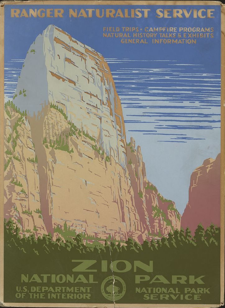
Zion National Park’s aerial view offers breathtaking vistas of towering sandstone cliffs, winding canyons, and unique geological formations. This guide explores key viewpoints, notable landmarks, and essential information for capturing stunning aerial imagery of Zion. From the iconic Angels Landing to the majestic Great White Throne, discover the best locations and techniques for photographing this natural wonder from above.
What Are the Best Viewpoints for Aerial Photography in Zion National Park?

Angels Landing
- Elevation: 5,790 feet (1,765 meters)
- GPS Coordinates: 37.2592° N, 112.9513° W
Angels Landing provides a spectacular aerial view of Zion Canyon. Its unique fin-like shape and sheer cliffs make it an ideal subject for drone photography. Capture the winding trail and the panoramic views of the surrounding landscape.
Canyon Junction
- Elevation: 4,000 feet (1,219 meters)
- GPS Coordinates: 37.1983° N, 112.9442° W
This location offers a broad view of the Virgin River and the canyon it has carved. Aerial shots from Canyon Junction showcase the scale and beauty of Zion Canyon, highlighting the river’s path through the towering cliffs.
East Rim Trail
- Elevation: 4,000 to 6,500 feet (1,219 to 1,981 meters)
- Trailhead GPS Coordinates: 37.2433° N, 112.9367° W
The East Rim Trail presents multiple vantage points for capturing the vast expanse of Zion Canyon. Aerial photography along this trail can reveal the park’s diverse landscapes and notable formations like the Great White Throne.
What Are the Most Notable Geological Formations for Aerial Views?

Zion Canyon
Zion Canyon, carved by the Virgin River, is the park’s centerpiece. Aerial views showcase its towering sandstone cliffs and narrow riverbed. Fly along the canyon to capture its length and depth, revealing the intricate patterns of erosion and the lush vegetation along the river.
The Watchman
- Elevation: 6,545 feet (1,995 meters)
- GPS Coordinates: 37.2083° N, 112.9875° W
The Watchman is a prominent rock formation visible from many parts of the park. Its distinctive shape and reddish hue make it a striking subject for aerial photography, especially during sunrise or sunset.
The Great White Throne
- Elevation: 6,744 feet (2,056 meters)
- GPS Coordinates: 37.2367° N, 112.9517° W
This massive white sandstone formation is one of Zion’s most recognizable landmarks. Aerial views can capture its imposing presence and the contrast it creates with the surrounding red rock landscape.
What Are the Regulations for Drone Usage in Zion National Park?
| Regulation Type | Details |
|---|---|
| Recreational Use | Prohibited within park boundaries |
| Commercial Use | May be permitted with a special use permit |
| No-Fly Zones | All areas within the park |
| Altitude Restrictions | Strict limits even with permits |
It’s crucial to note that as of the latest regulations, recreational drone use is prohibited in Zion National Park. Commercial drone use may be permitted with a special use permit from the National Park Service. Always check the current regulations before planning any aerial photography in the park.
What Are the Best Times for Aerial Photography in Zion?
- Golden Hour:
- Early morning (just after sunrise)
- Late afternoon (before sunset)
-
Enhances natural colors and creates dramatic shadows
-
Overcast Skies:
- Provides soft, even light
- Ideal for capturing detailed aerial images without harsh shadows
What Are the Associated Costs for Aerial Photography in Zion?
- Special Use Permits: Costs vary, typically including an application fee and potential monitoring fees
- Equipment Rentals: $100 to $500 per day, depending on drone quality and features
How Can I Create an Aerial Map of Zion National Park?
While a specific aerial map isn’t provided here, you can create your own using GPS coordinates and topographic maps. Include these key viewpoints:
- Angels Landing
- Canyon Junction
- East Rim Trail
- The Watchman
- The Great White Throne
Use mapping software or online tools to plot these points and plan your aerial photography route.
What Safety Considerations Should I Keep in Mind?
- Check weather forecasts and avoid flying during strong winds or storms
- Be aware of other park visitors and wildlife to minimize disturbances
- Follow all FAA guidelines for safe drone operation
- Respect altitude restrictions and no-fly zones
By adhering to these guidelines and regulations, you can capture stunning aerial views of Zion National Park while ensuring the safety and enjoyment of all park visitors.
References:
1. Zion National Park Official Website
2. FAA Recreational Drone Safety
3. YouTube – Zion National Park & best photo spots
